
Geospatial Solutions
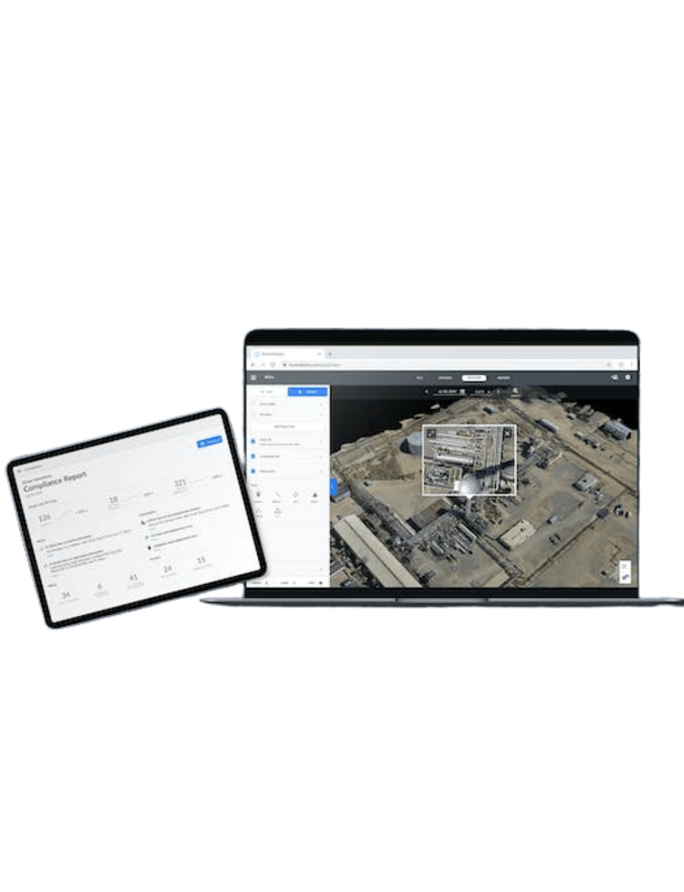
Drones
Elevating operations with world-class drone technology.
Why Choose Us?
GISsat is proud to be an official partner of HLCM Group Inc., a leading provider of geospatial and precision technology solutions across the Caribbean and Latin America. Through this strategic partnership, GISsat delivers Trimble, Spectra Geospatial, First Data, and other global brands to the Surinamese market with local sales, technical support, repairs, and training.
This partnership allows GISsat to offer a comprehensive lineup of field equipment and mapping hardware, fully compatible with Esri’s ArcGIS platform and tailored for industries such as land surveying, construction, utilities, mining, agriculture, environmental monitoring, and forensics.
Access to Global Brands
A curated selection of industry-leading geospatial brands, including Trimble, Spectra Geospatial, DJI, and YellowScan. Available through a single, trusted platform.
Official Warranted Equipment
All equipment is sourced directly from authorized channels, ensuring authenticity, manufacturer warranty, and long-term reliability.
Seamless Integration
Seamless integration between hardware (GNSS, UAV, scanners) and software (e.g. Esri ArcGIS)
Local Support, Global Innovation
As a local partner backed by global leaders, we provide personalized support while giving you access to the very latest in geospatial innovation.
Enterprise Drones
Experience advanced aerial solutions crafted for endurance, intelligence, and seamless integration
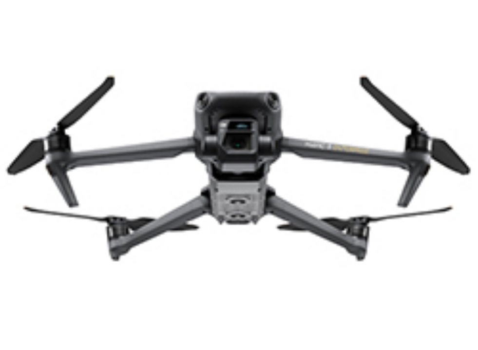
DJI Mavic 3 Enterprise
Your Everyday Commercial Drone
The Mavic 3 Enterprise Series redefines industry standards for small commercial drones. With a mechanical shutter, a 56x zoom camera, and an RTK module for centimeter-level precision, the Mavic 3E brings mapping and mission efficiency to new heights. A thermal version is available for firefighting, search and rescue, inspection, and night operations.
Specifications:
- Compact and Portable
- Flight Time: Up to 45 minutes
- 4/3 CMOS Wide Camera, 20MP, Mechanical Shutter
- Survey 2 Square Kilometers in a single flight
- RTK Module: Centimeter-level Positioning with RTK
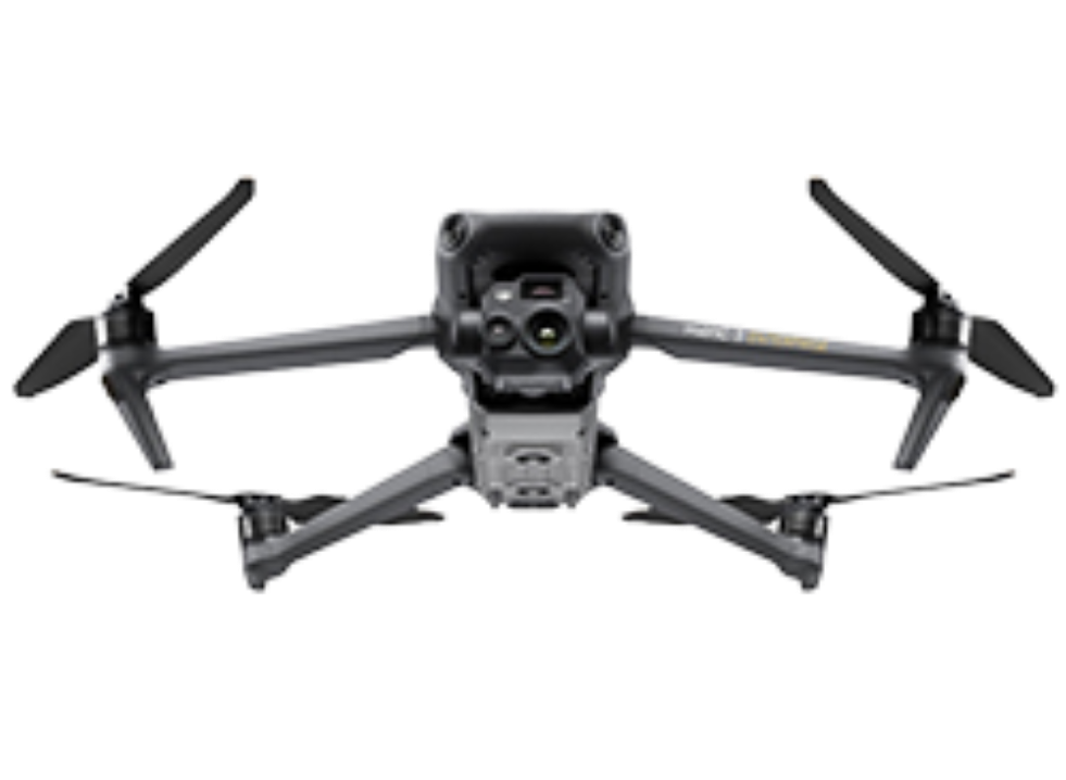
DJI Mavic 3 Thermal
Your Everyday Commercial Drone
The Mavic 3 Enterprise Series redefines industry standards for small commercial drones. With a mechanical shutter, a 56x zoom camera, and an RTK module for centimeter-level precision, the Mavic 3E brings mapping and mission efficiency to new heights. A thermal version is available for firefighting, search and rescue, inspection, and night operations
Specifications:
- Compact and Portable
- Flight Time: Up to 45 minutes
- 4/3 CMOS Wide Camera, 20MP, Mechanical Shutter
- Thermal: DFOV: 61°, Equivalent Focal Length: 40mm, Resolution 640 × 512
- Tele: Equivalent Focal Length: 162mm, 12MP, 56× Hybrid Zoom
- RTK Module: Centimeter-level Positioning with RTK
DJI Mavic 3 Multispetral
See More, Work Smarter
Effective aerial surveying needs to see the invisible. That's why Mavic 3 Multispectral has two forms of sight. It combines an RGB camera with a multispectral camera to scan and analyze crop growth with total clarity. Agricultural production management requires precision and data, and Mavic 3M delivers both.
Specifications:
- Compact and Portable
- Flight Time: Up to 45 minutes
- RBG Camera: 4/3 CMOS Wide Camera, 20MP, Mechanical Shutter
- Multipectral: 4 × 5MP G/R/RE/NIR
- Up to 200 hectares per flight
- DJI O3 Enterprise Transmission
- RTK Module: Centimeter-level Positioning with RTK
DJI Matrice 300 RTK
Built Tough. Works Smart.
The DJI Matrice 300 RTK sets a new standard for enterprise drones, delivering up to 55 minutes of flight time, 15 km transmission range, and advanced AI-powered capabilities. With 6-directional sensing and rugged reliability, it’s the ultimate aerial solution for mapping, inspection, and mission-critical operations.
Specifications:
- IP45 Rating
- Flight Time: Up to 55 minutes *no payload.
- Multi-Payload Support
- Supports Payloads: Zenmuse L1, P1, H20, H20T, H20N + third-party payloads
- Single downward gimbal
- Single Upward Gimbal x Single Downward Gimbal
- Single Upward Gimbal x Dual Downward Gimbals
- Maximum payload capacity: 2.7 kg
- Offering up to 31 minutes of flight time *at max payload, advanced AI capabilities, 6 Directional Sensing & Positioning and more
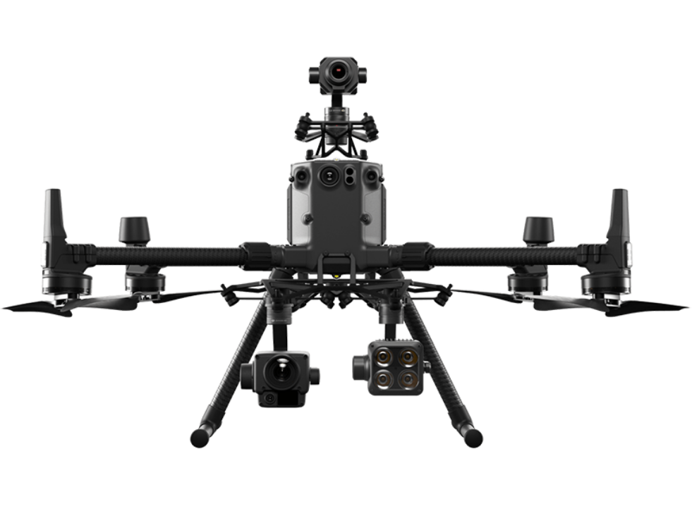
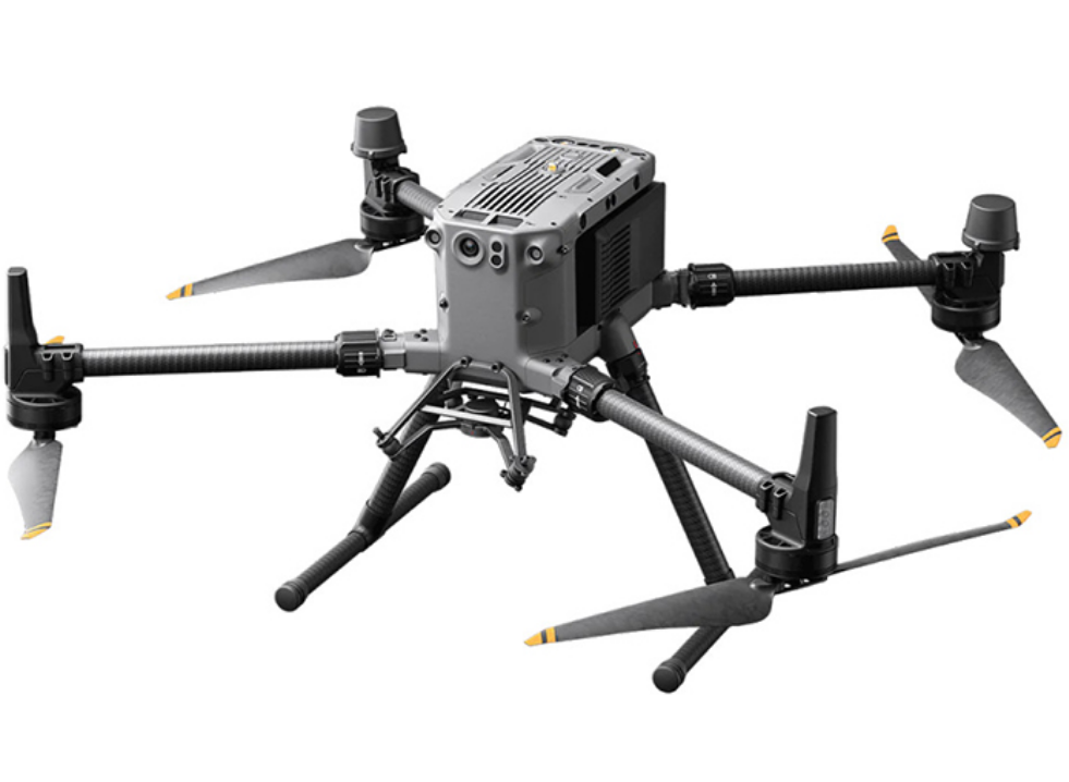
DJI Matrice 350 RTK
Fully Powered to Forge Ahead
An upgraded flagship drone platform, the Matrice 350 RTK sets a new benchmark for the industry. This next-generation drone platform features an all-new video transmission system and control experience, a more efficient battery system, and more comprehensive safety features, as well as robust payload and expansion capabilities. It is fully powered to inject innovative strength into any aerial operation.
Specifications:
- Flight Time: Up to 55 minutes *no payload.
- Multi-Payload Support
- Supports Payloads: Zenmuse L1, P1, H20, H20T, H20N + third-party payloads
- Single downward gimbal
- Single Upward Gimbal x Single Downward Gimbal
- Single Upward Gimbal x Dual Downward Gimbals
- Maximum payload capacity: 2.7 kg
- IP55 Rating
- DJI O3 Enterprise Transmission
- Night-Vision FPV Camera
- With the new BS65 Intelligent Battery Station & TB65 batteries, DJI RC Plus, advanced AI capabilities, 6 Directional Sensing & Positioning and more
Training & Support
Get the most out of your equipment with hands-on training and reliable technical support, every step of the way.
FAQ
Do you offer demos or consultations?
In many cases, we offer product demonstrations, consultations, and workflow assessments to help clients choose the right solution based on their project requirements.
How do I request a quote or place an order?
You can contact us directly via the website, phone, or email. Our team will assist you with product recommendations and provide a detailed quote based on your needs.
Get Started
Get started with ArcGIS
Request a product
Discover the right tools for your geospatial mission