
Geospatial Solutions
Spectra
Bringing world-class geospatial hardware and technologies to Suriname.
Why Choose Us?
GISsat is proud to be an official partner of HLCM Group Inc., a leading provider of geospatial and precision technology solutions across the Caribbean and Latin America. Through this strategic partnership, GISsat delivers Trimble, Spectra Geospatial, First Data, and other global brands to the Surinamese market with local sales, technical support, repairs, and training.
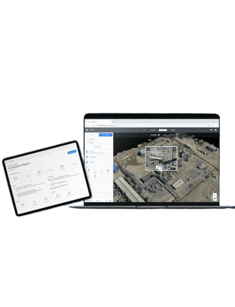
This partnership allows GISsat to offer a comprehensive lineup of field equipment and mapping hardware, fully compatible with Esri’s ArcGIS platform and tailored for industries such as land surveying, construction, utilities, mining, agriculture, environmental monitoring, and forensics.
Access to Global Brands
A curated selection of industry-leading geospatial brands, including Trimble, Spectra Geospatial, DJI, and YellowScan. Available through a single, trusted platform.
Official Warranted Equipment
All equipment is sourced directly from authorized channels, ensuring authenticity, manufacturer warranty, and long-term reliability.
Seamless Integration
Seamless integration between hardware (GNSS, UAV, scanners) and software (e.g. Esri ArcGIS)
Local Support, Global Innovation
As a local partner backed by global leaders, we provide personalized support while giving you access to the very latest in geospatial innovation.
Spectra GNSS surveying
Survey smarter with advanced GNSS technology engineered for dependable results in any environment.
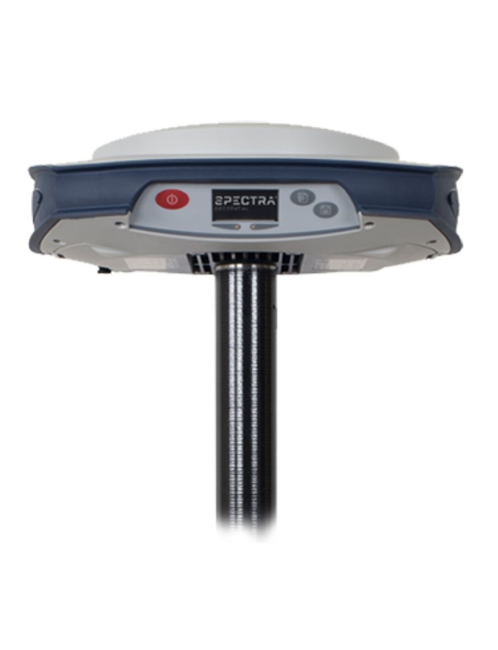
SP85
Combines decades of GNSS RTK technology with revolutionary new GNSS processing
The Spectra Geospatial® SP85 is a state-of-the-art GNSS receiver that combines decades of RTK GNSS technology with revolutionary new GNSS processing. With the new 600-channel "7G" circuitry, combined with the patented Z-BladeTM technology, the SP85 system is optimized for tracking and processing signals from all GNSS constellations in harsh conditions.
Specifications
- Patented Z-Blade™ technology
- 600-channel “7G”
- Hot-swappable batteries
- Internal TxRx UHF radio
- L-band satellite capable GNSS antenna
- 3.5G cellular modem
- Built-in WiFi communication
- Backup RTK & RTK bridge
- eLevel technology
SP60
Offering a high level of flexibility to cover any demand from GIS all the way up to sophisticated RTK solutions
The Spectra Geospatial SP60 is a new generation GNSS receiver offering a high level of flexibility to cover any demand from GIS all the way up to sophisticated RTK and Trimble RTX™ capable
solutions.
Specifications:
- Extended scalability
- Z-Blade GNSS-centric technology
- 240-channel 6G ASIC
- Anti-theft technology
- Long Range Bluetooth
- Trimble CenterPoint® RTX

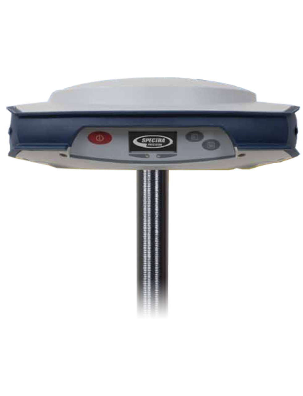
SP80
Powerful, rugged and easy-to-use system designed for everyday surveyors
The SP80 GNSS receiver uses Z-Blade processing technology running on a next generation Spectra Precision 240-channel 6G ASIC that fully uses all six GNSS systems: GPS, GLONASS, BeiDou, Galileo, QZSS and SBAS. The unique GNSS-centric capability optimally combines GNSS signals without dependency on any specific GNSS system; allowing operations in GLONASS-only or BeiDou-only mode if needed.
Specifications:
- Z-Blade GNSS-centric technology
- WiFi, SMS and e-mail communication
- Anti-theft technology
- eLevel technology
- Backup RTK and RTK bridge
- Hot-swappable batteries
- Inside-the-rod antenna
- 3.5G cellular modem
- Trimble RTX correction services
Optical Surveying Nikon solutions
To inquire about the Optical Surveying Nikon solutions
Request via e-mail
to: info@gissat.com
Training & Support
Get the most out of your equipment with hands-on training and reliable technical support, every step of the way.
FAQ
Do you offer demos or consultations?
In many cases, we offer product demonstrations, consultations, and workflow assessments to help clients choose the right solution based on their project requirements.
How do I request a quote or place an order?
You can contact us directly via the website, phone, or email. Our team will assist you with product recommendations and provide a detailed quote based on your needs.
Get Started
Get started with ArcGIS
Request a product
Discover the right tools for your geospatial mission