
Geospatial Solutions
YellowScan
Redefining terrain intelligence with world-class LiDAR solutions.
Why Choose Us?
GISsat is proud to be an official partner of HLCM Group Inc., a leading provider of geospatial and precision technology solutions across the Caribbean and Latin America. Through this strategic partnership, GISsat delivers Trimble, Spectra Geospatial, First Data, and other global brands to the Surinamese market with local sales, technical support, repairs, and training.
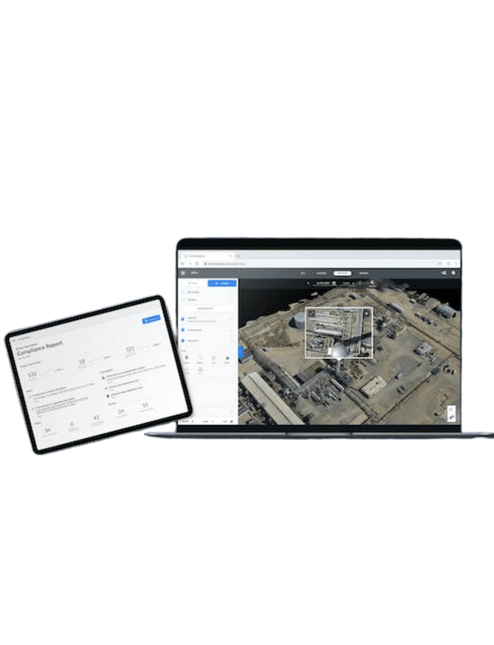
This partnership allows GISsat to offer a comprehensive lineup of field equipment and mapping hardware, fully compatible with Esri’s ArcGIS platform and tailored for industries such as land surveying, construction, utilities, mining, agriculture, environmental monitoring, and forensics.
Access to Global Brands
A curated selection of industry-leading geospatial brands, including Trimble, Spectra Geospatial, DJI, and YellowScan. Available through a single, trusted platform.
Official Warranted Equipment
All equipment is sourced directly from authorized channels, ensuring authenticity, manufacturer warranty, and long-term reliability.
Seamless Integration
Seamless integration between hardware (GNSS, UAV, scanners) and software (e.g. Esri ArcGIS)
Local Support, Global Innovation
As a local partner backed by global leaders, we provide personalized support while giving you access to the very latest in geospatial innovation.
YellowScan LiDAR Solutions
Unlock advanced LiDAR technology designed for precision, reliability, and effortless data integration.
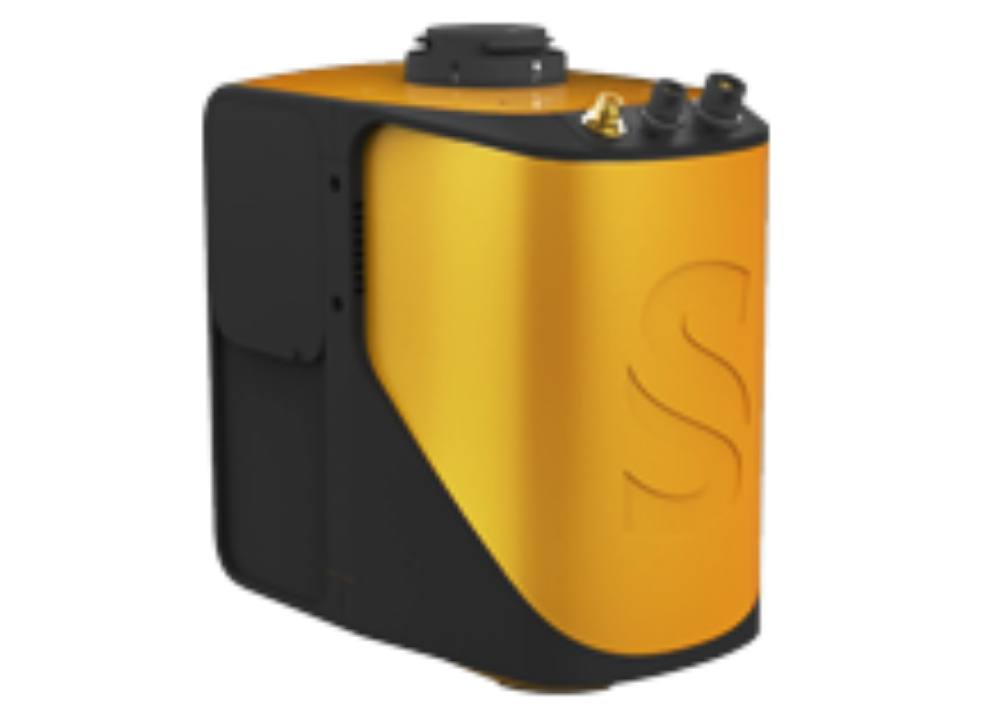
Mapper
Easy mapping redefined
Start your LiDAR journey with our easy-to-use Mapper system. Its low weight, mid-range capability, top-end point density and advanced accuracy and precision, makes this LiDAR system the best value for money.
Cover 10ha in 3 minutes *flying at 70m AGL, 10 m/s, with 40% sidelap.
For optimized productivity, we recommend a balanced 10 m/s flight speed for optimal point density.
Specifications:
- System Accuracy: 4 cm
- System Precision: 4 cm
- Typ. flight speed: 10 m/s
- Typ. AGL altitude: 70 m
- Laser Scanner Range: up to 130 m
- Scanner: Livox Horizon
- GNSS-Inertial solution: Applanix APX-15 UAV
- Scanner field-of-view: 81.7 ° x 25.1°
- Echoes per shot: Up to 2
- Shots per second: Up to 240k
- Scanning frequency: Up to 10 Hz
- Weight battery excl. 1.3 kg (3.31 lbs)
- Size: L 14.3 x W 9.8 x H 14.9 cm
- Operating temperature: -10 to +40°C
- Camera: Compatible with an optional RGB camera module
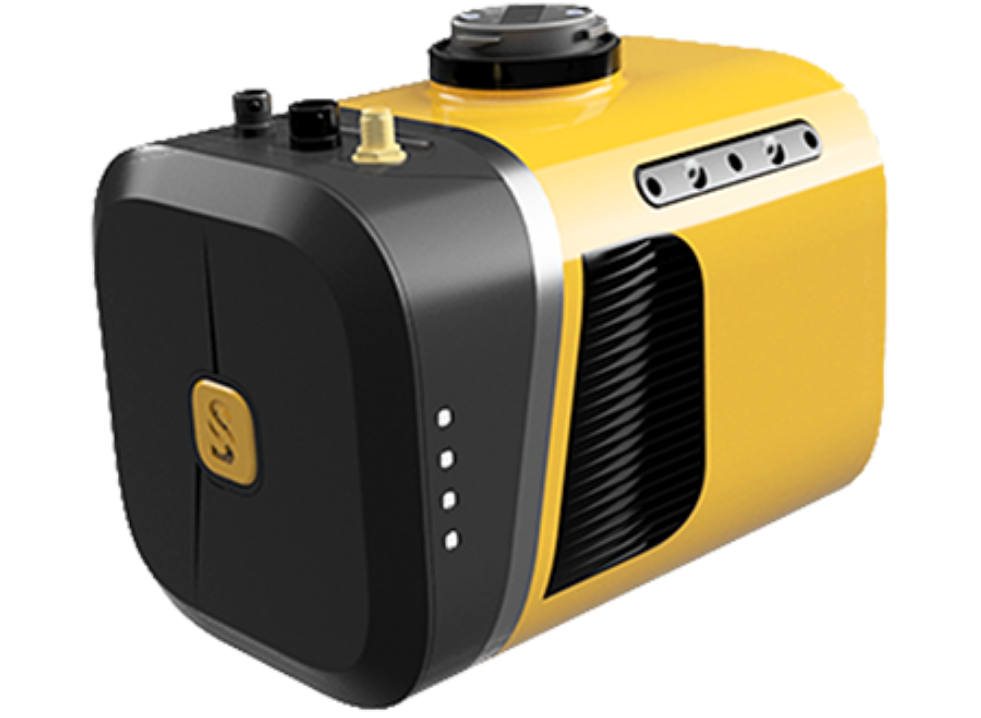
Mapper+
Your Everyday Commercial Drone
Advanced performance fitted into a compact survey solution. The YellowScan Mapper+ is the lightest three echoes and high-density LiDAR system.
Great quality data in any scenarios. Ideally suited for projects requiring higher flight speed. Flight operation speed from 5 to 20m/s with a flying height of up to 100m.
Specifications:
- System Accuracy: 4 cm
- System Precision: 3.5 cm
- Typ. flight speed: 10 m/s
- Typ. AGL altitude: 100 m
- Laser Range: up to 230 m
- Laser Scanner: Livox AVIA
- GNSS-Inertial solution: Applanix APX-15 UAV
- Scanner field-of-view: 70.4° x 4.5°
- Echoes per shot: Up to 3
- Shots per second: Up to 240k
- Scanning frequency: Up to 10 Hz
- Weight battery incl. 1.3 kg (2.9 lbs)
- Size: L 15 x W 10.4 x H 12.8 cm
- Operating temperature: -20 to +40°C
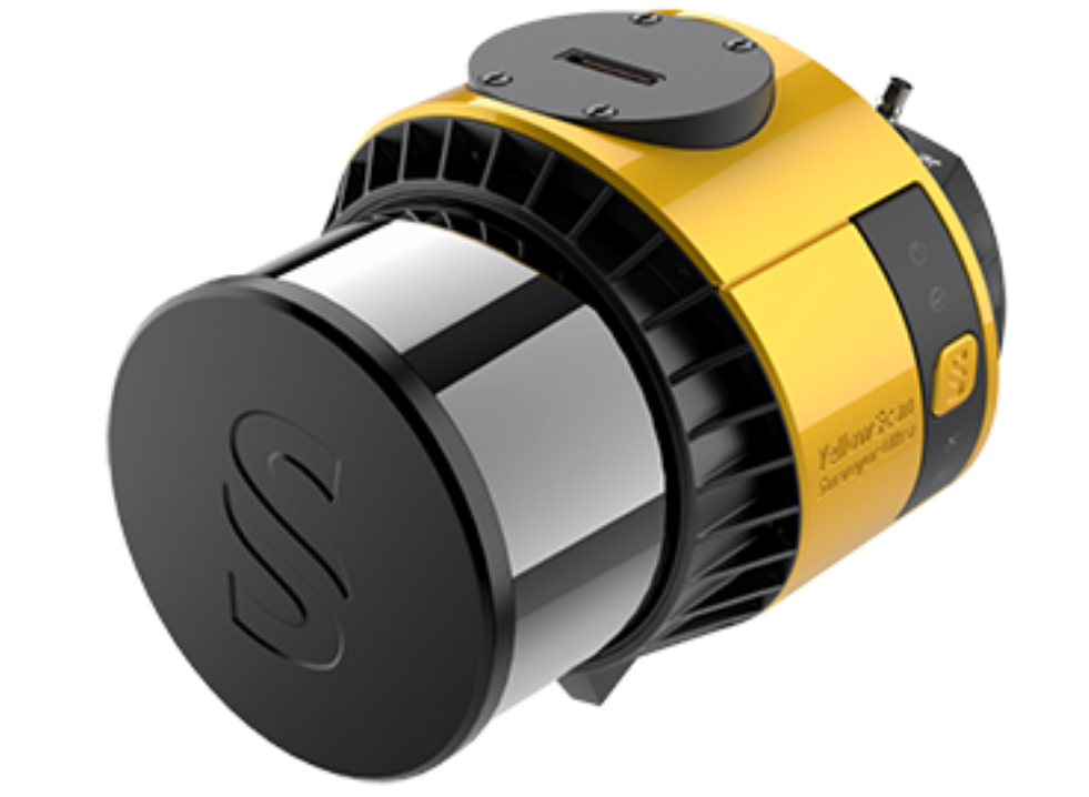
Surveyor Ultra
See More, Work Smarter
With its 360° field of view, the YellowScan Surveyor Ultra answers vertical mapping and mobile mapping needs when combined with Fly&Drive.
Expect unparalleled vegetation penetration thanks to this system’s 32 laser beams.
Specifications:
- System Accuracy: 2.5 cm
- System Precision: 3 cm
- Typ. flight speed: 10 m/s
- Typ. AGL altitude: 140 m
- Laser Range: up to 300 m
- Laser Scanner: Hesai XT32M2X
- GNSS-Inertial solution: SBG Quanta Micro
- Scanner field-of-view: 360° x 40.3°
- Echoes per shot: Up to 3
- Shots per second: Up to 640k
- Scanning frequency: Up to 20 Hz
- Weight battery excl. 0.98 kg (2.2 lbs)
- Size: L 15.3 x W 11.3 x H 11.7 cm
- Operating temperature: -10 to +40°C
- Built-in 2MP global shutter RGB camera
- Camera: Compatible with an optional Single 20MP/60MP or Dual 35MP RGB camera module
other YellowScan solutions
To inquire about other YellowScan solutions.
Request via e-mail
to: info@gissat.com
Training & Support
Get the most out of your equipment with hands-on training and reliable technical support, every step of the way.
FAQ
Do you offer demos or consultations?
In many cases, we offer product demonstrations, consultations, and workflow assessments to help clients choose the right solution based on their project requirements.
How do I request a quote or place an order?
You can contact us directly via the website, phone, or email. Our team will assist you with product recommendations and provide a detailed quote based on your needs.
Get Started
Get started with ArcGIS
Request a product
Discover the right tools for your geospatial mission