— 5ᵗʰ Annual Suriname’s largest GIS conference
GISsat User Conference 2026
December 1st, 2026 | Royal Ballroom Torarica
GIS-Creating a more intelligent world
This year’s theme: GIS-Creating a more intelligent world
This year's theme is:
GIS – Integrating Everything, Everywhere
Bringing Domains Together Through GIS
Special Interest Group
Attending a special interest group meeting (SIG) at the GISsat User Conference is the perfect way to connect in person with like-minded peers. These sessions are focused on discussions and sharing best practices with GIS professionals who work in the same industry or do similar workflows.
Showcase Expo Island
In the business showcase expo island, you will find demo kiosks with representatives from industries such as Natural Resources, Utility, Surveying, Environmental, Infrastructure and more.
TechExpo sessions
Attend Tech sessions on ArcGIS Experience Builder, ArcGIS Hub, and ArcGIS FlightPlan. Discover the latest tools and see how these technologies can elevate your geospatial projects. Don’t miss out on these must-attend demos!
Networking & Business Socializing
Connect with like-minded business professionals who are working in GIS within their business sector.
Special Interest Group
Connect with GIS Professionals Who Share Your Workflows
Attending a Special Interest Group meeting (SIG) at the GISsat User Conference is the perfect way to connect in person with like-minded peers. These sessions focus on discussions and sharing best practices with GIS professionals who work in the same industry or do similar workflows.
Showcase Expo Island - Coming Soon
Explore Industry Solutions Across Every Sector
In the business showcase expo island, you will find demo kiosks with representatives from industries such as Natural Resources, Utility, Surveying, Environmental, Infrastructure, and more. Engage directly with experts and see how GIS is transforming every domain.
TechExpo Sessions - Coming soon
Deep Dives on ArcGIS Experience Builder, Hub & FlightPlan
Attend technical sessions on ArcGIS Experience Builder, ArcGIS Hub, and ArcGIS FlightPlan. Discover the latest tools and see how these technologies can elevate your geospatial projects. Don't miss out on these must-attend demos.
Networking & Business Socializing
Build Partnerships with Suriname's GIS Community
Connect with like-minded business professionals working in GIS within your sector. Share ideas, build partnerships, and spark conversations that can transform your work and career — all in one day at Royal Ballroom Torarica.

Early Bird pricing for non-GISsat clients
USD80 valid until 4 November 2025
Regular price USD97
GISsat clients Extra pass pricing
USD50

Get Your Pass here
Register via this link to receive an email with your invoice.
For questions, e-mail events@gissatcloud.com

Global Agenda
As we get closer to the GISsat User Conference 2025, the detailed agenda will be completed and shared with you.
13:30 – 14:00 | Walk-in, coffee, tea
14:00 – 16:30 | Opening and start Part 1: Special Interest Group (SIG) presentations
16:30 – 17:00 | Coffee, tea and snack break
17:00 – 18:00 | Part 2: Technical presentations
18:00 – 18:30 | Panel Discussion and Q&A
18:30 – 19:30 | Tech Expo Focus; all visitors to booths. Booths showcasing their GIS work
19:30 – 21:00 | Networking & Closure
2026 Agenda - To be confirmed
The sessions below reflect last year's programme. The 2026 agenda is being finalised, check back soon for confirmed timings and speakers.
Agenda 2025
A full day of insights, demos, and connections. The detailed agenda will be completed and shared with you as we get closer to the event.
13:30 – 14:00 | Walk-in, Coffee & Tea
Arrive, settle in, and connect with fellow attendees.
14:00 – 16:30 | Opening & Part 1: Special Interest Group (SIG) Presentations
Keynotes open the conference, followed by SIG sessions connecting GIS professionals across industries.
16:30 – 17:00 | Coffee, Tea & Snack Break
Recharge and mingle with speakers and fellow GIS professionals.
17:00 – 18:00 | Part 2: Technical Presentation
Deep-dive sessions on ArcGIS Experience Builder, ArcGIS Hub, and ArcGIS FlightPlan.
18:00 – 18:30 | Panel Discussion & Q&A
Open forum with speakers and industry leaders.
18:30 – 19:30 | Tech Expo Focus
Visit all booths showcasing GIS work. All visitors are encouraged to explore each exhibitor.
19:30 – 21:00 | Networking & Closure
Wind down, exchange contacts, and celebrate Suriname’s vibrant GIS community.
Featured Speakers
Industry leaders sharing their vision on the future of GIS in Suriname and beyond.
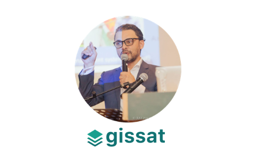
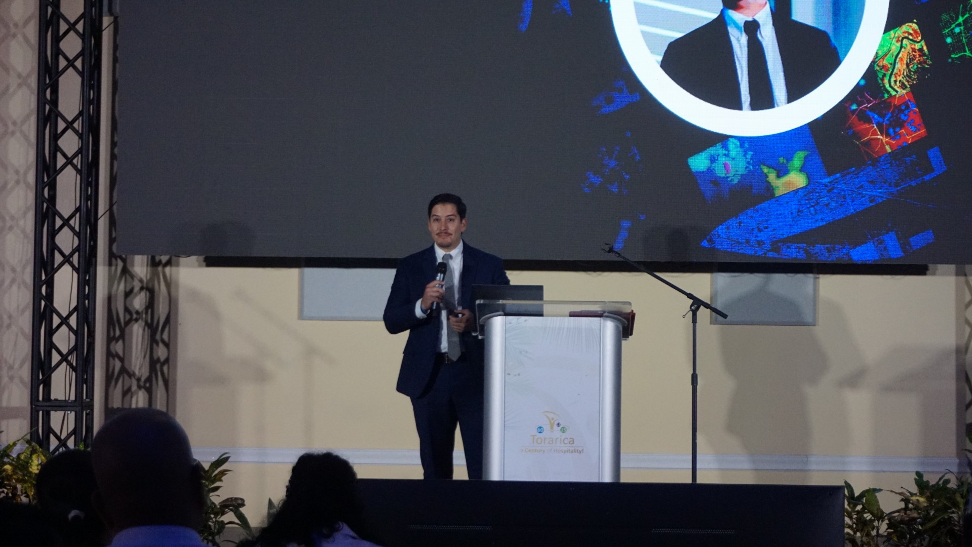
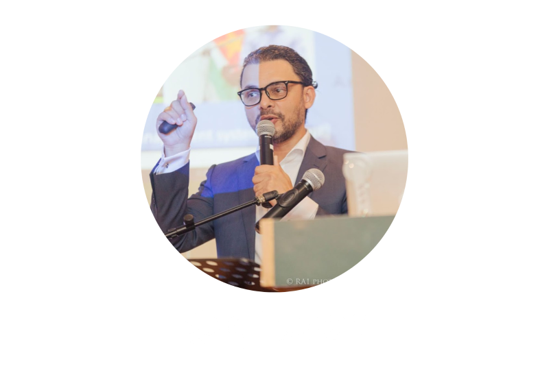
Stef de Ridder
CEO at GISsat N.V.
Stef de Ridder has been a pioneer in Suriname's GIS industry for over 30 years. With a background in Engineering, Spatial Planning, and Land Surveying, he has dedicated his career to building the foundation of geospatial innovation in the region. Since his early work at the Anton de Kom University of Suriname in the 1990s, Stef has been instrumental in cultivating a vibrant GIS ecosystem.
Stef de Ridder
CEO at GISsat N.V.
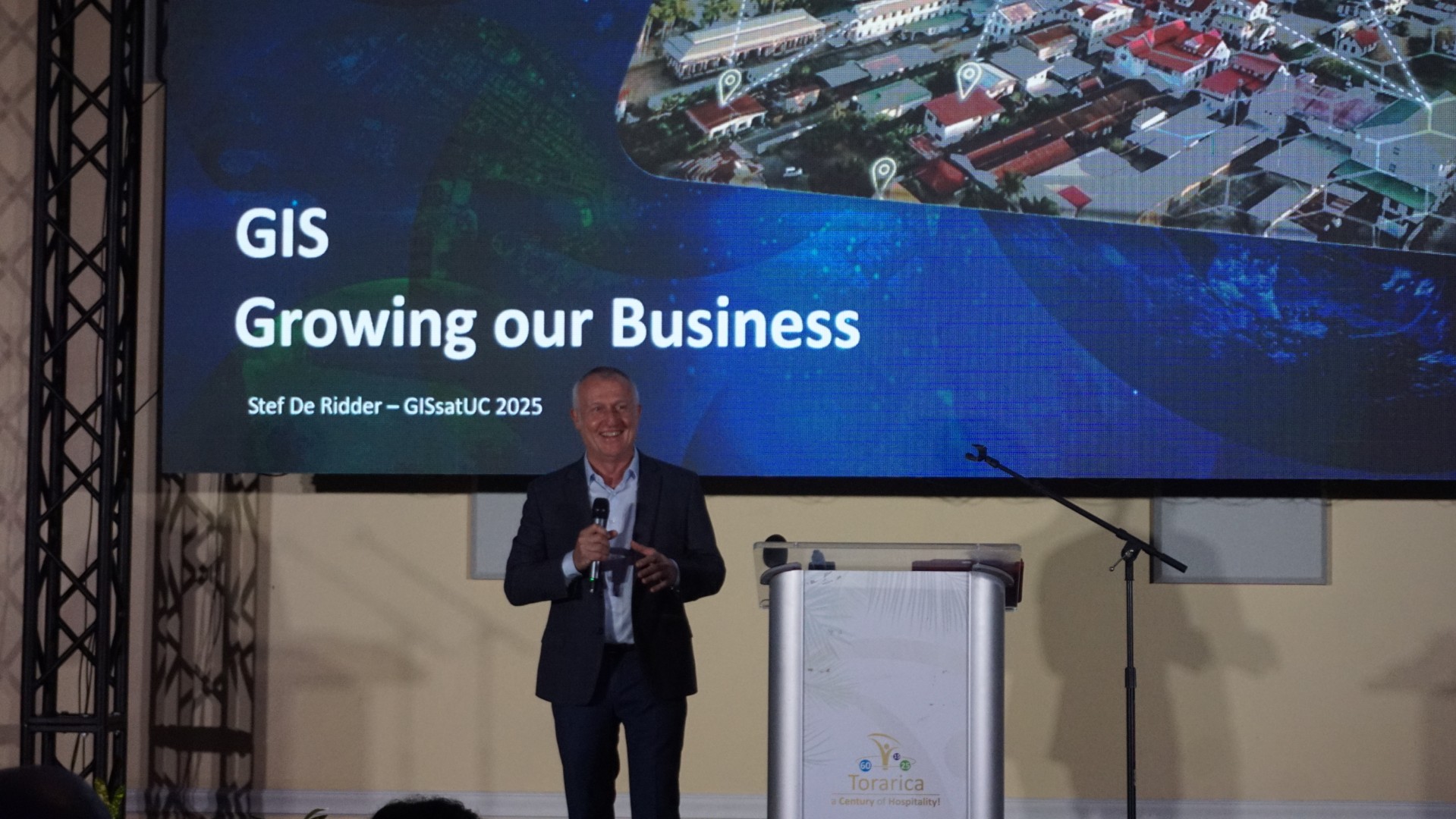
In his keynote, “GIS – Driving Business in Suriname.”, Stef will explore how geospatial technology is evolving beyond mapping into intelligent systems that drive decision-making to grow our business and to boost national development.
Stef de Ridder
CEO at GISsat N.V.
Keynote
Stef de Ridder
CEO at GISsat N.V.
A pioneer in Suriname's GIS industry for over 30 years. With a background in Engineering, Spatial Planning, and Land Surveying, he has dedicated his career to building the foundation of geospatial innovation in the region. His early work at Anton de Kom University in the 1990s shaped Suriname's vibrant GIS ecosystem.
Stef de Ridder
CEO at GISsat N.V.
In his keynote, “GIS – Driving Business in Suriname.”, Stef will explore how geospatial technology is evolving beyond mapping into intelligent systems that drive decision-making to grow our business and to boost national development.
Krieshen Ramkhelawan
Managing Director at GISsat N.V.
Brings nearly 25 years of experience driving digital transformation across government and industry. He has modernised land administration, public cadastre, and social protection systems in Suriname, guiding organisations to successfully integrate GIS technology into their operations.
Krieshen Ramkhelawan
Managing Director at GISsat N.V.
In his keynote, “GIS in a Flash: Highlights of Geospatial Innovation in Suriname”, Krieshen will showcase the latest developments shaping Suriname’s geospatial landscape and how these innovations empower both public and private organizations.
Sheetal Sujan

Director at Lybra Training, Coaching & Consulting NV - Esri Partner
Lybra specializes in digital transformations by optimizing processes, developing tailored information systems enriched with Location Intelligence and integrated with ArcGIS platform components. In addition to its technological focus, Lybra is dedicated to people transformations, helping organizations build resilient, high-performing teams and fostering positive workplace cultures. Our comprehensive approach includes leadership development, emotional intelligence, productivity management, and communication training, empowering individuals to adapt and thrive in evolving work environments.Sheetal Sujan is a pivotal project team member and the strategic leader behind Lybra Training, Coaching & Consulting. Her extensive global experience—ranging from the vibrant culture of the Philippines, through the academic rigor of Miami, to the tranquil beauty of Suriname—enriches her leadership and strategic contributions to our projects. At Lybra, Sheetal leverages her passion for leadership development and her keen understanding of organizational dynamics to drive people and digital transformations, enhancing organizational capacities through both innovative technologies and effective, people-centered strategies.
Sheetal Sujan
Director at Lybra Training, Coaching & Consulting NV - Esri Partner
Lybra specializes in digital transformations by optimizing processes, developing tailored information systems enriched with Location Intelligence and integrated with ArcGIS platform components.
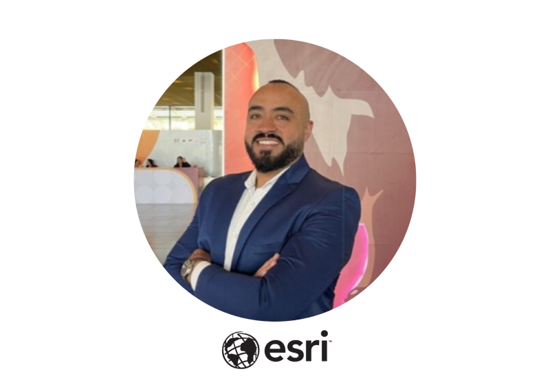
Geovanny Solera
Business Development Manager, Americas at Esri
Geovanny Solera is an experienced geospatial professional with a strong background in helping utilities harness the power of GIS. With expertise in digital transformation, network modeling, and business integration, he has supported organizations in adopting Modern Network Information Management Systems and digital twin technologies to improve efficiency and reliability.
Speaker to be announced soon
N.V. Surinaamsche Waterleiding Maatschappij (SWM)
In his presentation, “GIS for Infrastructure & Utilities”, Geovanny will share how utilities can move beyond traditional mapping towards intelligent, network-aware systems that drive smarter decision-making.
Geovanny Solera
Business Development Manager, Americas at Esri
Geovanny Solera is an experienced geospatial professional with a strong background in helping utilities harness the power of GIS. With expertise in digital transformation, network modeling, and business integration, he has supported organizations in adopting Modern Network Information Management Systems and digital twin technologies to improve efficiency and reliability.
Speaker to be announced soon
De Vereniging van Inheemse Dorpshoofden in Suriname (VIDS)
In his presentation, “GIS for Infrastructure & Utilities”, Geovanny will share how utilities can move beyond traditional mapping towards intelligent, network-aware systems that drive smarter decision-making.
Geovanny Solera
Business Development Manager, Americas at Esri
Geovanny Solera is an experienced geospatial professional with a strong background in helping utilities harness the power of GIS. With expertise in digital transformation, network modeling, and business integration, he has supported organizations in adopting Modern Network Information Management Systems and digital twin technologies to improve efficiency and reliability.
Speaker to be announced soon
FATUM
Lybra specializes in digital transformations by optimizing processes, developing tailored information systems enriched with Location Intelligence and integrated with ArcGIS platform components.
Geovanny Solera
Business Development Manager, Americas at Esri
Geovanny Solera is an experienced geospatial professional with a strong background in helping utilities harness the power of GIS. With expertise in digital transformation, network modeling, and business integration, he has supported organizations in adopting Modern Network Information Management Systems and digital twin technologies to improve efficiency and reliability.
Speaker to be announced soon
De Nationale Ontwikkelingsbank van Suriname N.V. (NOB)
Lybra specializes in digital transformations by optimizing processes, developing tailored information systems enriched with Location Intelligence and integrated with ArcGIS platform components.
Geovanny Solera
Business Development Manager, Americas at Esri
Geovanny Solera is an experienced geospatial professional with a strong background in helping utilities harness the power of GIS. With expertise in digital transformation, network modeling, and business integration, he has supported organizations in adopting Modern Network Information Management Systems and digital twin technologies to improve efficiency and reliability.
Speaker to be announced soon
Nationale Milieu Autoriteit (NMA) & Green Heritage Fund Suriname (GHFS)
Lybra specializes in digital transformations by optimizing processes, developing tailored information systems enriched with Location Intelligence and integrated with ArcGIS platform components.
Stef de Ridder
CEO at GISsat N.V.
A pioneer in Suriname's GIS industry for over 30 years. With a background in Engineering, Spatial Planning, and Land Surveying, he has dedicated his career to building the foundation of geospatial innovation in the region. His early work at Anton de Kom University in the 1990s shaped Suriname's vibrant GIS ecosystem.
Stef de Ridder
CEO at GISsat N.V.
In his keynote, “GIS – Driving Business in Suriname.”, Stef will explore how geospatial technology is evolving beyond mapping into intelligent systems that drive decision-making to grow our business and to boost national development.
Krieshen Ramkhelawan
Managing Director at GISsat N.V.
Brings nearly 25 years of experience driving digital transformation across government and industry. He has modernised land administration, public cadastre, and social protection systems in Suriname, guiding organisations to successfully integrate GIS technology into their operations.
Krieshen Ramkhelawan
Managing Director at GISsat N.V.
In his keynote, “GIS in a Flash: Highlights of Geospatial Innovation in Suriname”, Krieshen will showcase the latest developments shaping Suriname’s geospatial landscape and how these innovations empower both public and private organizations.
Geovanny Solera
Business Development Manager, Americas at Esri
Geovanny Solera is an experienced geospatial professional with a strong background in helping utilities harness the power of GIS. With expertise in digital transformation, network modeling, and business integration, he has supported organizations in adopting Modern Network Information Management Systems and digital twin technologies to improve efficiency and reliability.

Geovanny Solera
Business Development Manager, Americas at Esri
In his presentation, “GIS for Infrastructure & Utilities”, Geovanny will share how utilities can move beyond traditional mapping towards intelligent, network-aware systems that drive smarter decision-making.
Sheetal Sujan
Director at Lybra Training, Coaching & Consulting NV - Esri Partner
Lybra specializes in digital transformations by optimizing processes, developing tailored information systems enriched with Location Intelligence and integrated with ArcGIS platform components. In addition to its technological focus, Lybra is dedicated to people transformations, helping organizations build resilient, high-performing teams and fostering positive workplace cultures. Our comprehensive approach includes leadership development, emotional intelligence, productivity management, and communication training, empowering individuals to adapt and thrive in evolving work environments.Sheetal Sujan is a pivotal project team member and the strategic leader behind Lybra Training, Coaching & Consulting. Her extensive global experience—ranging from the vibrant culture of the Philippines, through the academic rigor of Miami, to the tranquil beauty of Suriname—enriches her leadership and strategic contributions to our projects. At Lybra, Sheetal leverages her passion for leadership development and her keen understanding of organizational dynamics to drive people and digital transformations, enhancing organizational capacities through both innovative technologies and effective, people-centered strategies.
Sheetal Sujan
Director at Lybra Training, Coaching & Consulting NV - Esri Partner
Lybra specializes in digital transformations by optimizing processes, developing tailored information systems enriched with Location Intelligence and integrated with ArcGIS platform components.
Krieshen Ramkhelawan
Managing Director at GISsat N.V.
In his keynote, “GIS in a Flash: Highlights of Geospatial Innovation in Suriname”, Krieshen will showcase the latest developments shaping Suriname’s geospatial landscape and how these innovations empower both public and private organizations.
Geovanny Solera
Business Development Manager, Americas at Esri
In his presentation, “GIS for Infrastructure & Utilities”, Geovanny will share how utilities can move beyond traditional mapping towards intelligent, network-aware systems that drive smarter decision-making.
Stef de Ridder
CEO at GISsat N.V.
Stef de Ridder has been a pioneer in Suriname’s GIS industry for over 30 years. With a background in Engineering, Spatial Planning, and Land Surveying, he has dedicated his career to building the foundation of geospatial innovation in the region. Since his early work at the Anton de Kom University of Suriname in the 1990s, Stef has been instrumental in cultivating a vibrant GIS ecosystem.
In his keynote, “GIS – Driving Business in Suriname.”, Stef will explore how geospatial technology is evolving beyond mapping into intelligent systems that drive decision-making to grow our business and to boost national development.
Krieshen Ramkhelawan
Managing Director at GISsat N.V.
Krieshen Ramkhelawan brings nearly 25 years of experience driving digital transformation across government and industry. He has played a pivotal role in modernizing land administration, public cadastre, and social protection systems in Suriname, while guiding organizations to successfully integrate GIS technology into their operations.
Known for his practical and straightforward approach, Krieshen helps clients become self-reliant and efficient in their digital journeys. His leadership has positioned GISsat as a trusted partner in making data-driven decision-making accessible across sectors.
In his keynote, “GIS in a Flash: Highlights of Geospatial Innovation in Suriname”, Krieshen will showcase the latest developments shaping Suriname’s geospatial landscape and how these innovations empower both public and private organizations.
Geovanny Solera
Business Development Manager, Americas at Esri
Geovanny Solera is an experienced geospatial professional with a strong background in helping utilities harness the power of GIS. With expertise in digital transformation, network modeling, and business integration, he has supported organizations in adopting Modern Network Information Management Systems and digital twin technologies to improve efficiency and reliability.
In his presentation, “GIS for Infrastructure & Utilities”, Geovanny will share how utilities can move beyond traditional mapping towards intelligent, network-aware systems that drive smarter decision-making.

Clayton Nam Wong Ching
Business Development Manager at GISsat N.V.
Clayton Nam Wong Ching is a certified Esri professional with nearly two decades of experience in designing advanced GIS solutions. He specializes in building intuitive geospatial workflows that ensure data integrity and maximize the capabilities of the ArcGIS platform. At GISsat, Clayton has been instrumental in supporting clients across multiple industries, helping them transform complex challenges into actionable insights.
In the joint presentation, “When Maps Think: GeoAI and the Rise of Spatial Copilots”, Clayton will demonstrate how artificial intelligence is reshaping GIS by enabling smarter, more automated decision-making through ArcGIS.
Clifton Karwofodi
Operations Manager for Policy Administration & Inspection at Assuria N.V.
Clifton Karwofodi has over 25 years of experience in insurance operations, risk management, and digital transformation. Under his leadership, Assuria has modernized its core business processes, embracing GIS (Geographic Information Systems) as a cornerstone of its innovation strategy and becoming the first insurer in Suriname to leverage geospatial technology for field data collection, risk assessment, and spatial analytics. Through this initiative, Assuria, Suriname’s leading insurance company, is transforming how insurance intelligence is created, enabling faster inspections, smarter risk evaluation, and a new level of geographic insight into client portfolios and risk zones.

“The insurance industry is no longer about paperwork — it’s about data, precision, and location. At Assuria, we saw this coming — and decided to lead, not follow.” — Clifton Karwofodi, Assuria N.V.

Pablo Lima
Product Director at PixForce
Pablo Lima is at the forefront of industrial innovation, leading Artificial Intelligence and Computer Vision projects at PixForce. He specializes in developing solutions for the Industry 4.0, Oil & Gas, and Energy sectors, leveraging technology to overcome their most complex challenges. His expertise is built on a solid international career managing multidisciplinary teams and delivering high-value technology programs.
Sheetal Sujan
Director at Lybra Training, Coaching & Consulting NV - Esri Partner
Lybra specializes in digital transformations by optimizing processes, developing tailored information systems enriched with Location Intelligence and integrated with ArcGIS platform components. In addition to its technological focus, Lybra is dedicated to people transformations, helping organizations build resilient, high-performing teams and fostering positive workplace cultures. Our comprehensive approach includes leadership development, emotional intelligence, productivity management, and communication training, empowering individuals to adapt and thrive in evolving work environments.
Sheetal Sujan is a pivotal project team member and the strategic leader behind Lybra Training, Coaching & Consulting. Her extensive global experience—ranging from the vibrant culture of the Philippines, through the academic rigor of Miami, to the tranquil beauty of Suriname—enriches her leadership and strategic contributions to our projects. At Lybra, Sheetal leverages her passion for leadership development and her keen understanding of organizational dynamics to drive people and digital transformations, enhancing organizational capacities through both innovative technologies and effective, people-centered strategies.

Luc De Heyn
Chief Commercial Officer at Merkator
Everyone talks about AI, but as long as your data is fragmented, incomplete, or outdated, the promise remains unfulfilled. In the session, “AI Won’t Save you from Bad Data: the Path to a True Digital Twin”, you’ll discover how organizations transition from separate GIS files and spreadsheets to a reliable, connected Digital Twin. We discuss four maturity levels and demonstrate how the MarlinDT platform integrates project, document, and GIS data into a single, up-to-date source of truth—an essential foundation for any AI application on your network.
Luc De Heyn is a civil engineer who combines technical expertise with a passion for innovation. He currently leads the go-to-market strategy for the Merkator Group, focusing on network operators and smart cities. With Marlin Digital Twin, Merkator supports customers worldwide in their transition from traditional network registration to true digital twins—the foundation for valuable AI applications. Luc is known as a creative, athletic, and inspiring speaker who brings technology to life.
Stephanie Sie Tjam Soi
Information Management Engineer at the Staatsolie Hydrocarbon Institute (SHI)
With a background in Geoscience and over seven years of experience in the energy sector, Stephanie will share how GIS technology is being used to unlock Suriname’s subsurface data –supporting data driven decisions.


Luis Diaz
Lead Customer Success Manager at Vantor
Luis Diaz serves as Lead Customer Success Manager at Vantor, where he partners with international government and commercial customers to help them realize the full value of Vantor’s geospatial intelligence solutions. In his role, Luis leads strategic initiatives focused on customer engagement, adoption, and retention ensuring clients achieve mission and business outcomes through effective use of Vantor’s technology. Luis joins us to explain how Vantor’s satellite imagery is included directly within ArcGIS as part of the default basemap offerings. His session will show how users can immediately benefit from this integrated, ready-to-use imagery.
Milad Elias
Lead Project Engineer at Baitali
Milad studied Civil Engineering at the Delft University of Technology from 2009 to 2014. He then joined Heijmans NV in the Netherlands (2014–2021), where he worked on major infrastructure projects and developed strong experience in design, execution and project coordination.
Since 2021 he has been with Aannemingsmaatschappij Baitali (AMB) in Suriname. He is currently involved in the DORDt shore-base development in Commewijne, a modern logistics and offshore-support hub being constructed on the former Plantage Dordrecht. In addition, he plays a role in the rehabilitation of the Paramaribo Waterkant as part of the Paramaribo Urban Rehabilitation Program (PURP), a key project for the revitalisation of the historic city centre.
At the GISsat User Conference 2025, Milad will share how Digital Twin technology is increasingly part of his engineering and project-management work, and how GIS forms the foundational layer for building, maintaining and analysing these Digital Twins in real-world infrastructure projects.
Outside of work, Milad enjoys travelling, tennis, running, swimming and, since 2022, rally driving. He lives with his partner in Wanica.


Giovanny Saidam
GIS Engineer - Energie Bedrijven Suriname N.V.
Giovanny Saidam is the GIS Enterprise Engineer responsible for installing and maintaining the high-availability Enterprise GIS environment at EBS over the past several years. At the GISsat User Conference 2025, he will share the latest developments in how EBS is leveraging GIS as a core pillar of its Digital Transformation. Giovanny will present the innovative ‘SmartGrid’ project and highlight the organizational impact and operational improvements that GIS adoption is bringing across the utility.
David Barbosa
Sr. International Technical Account Manager at Esri
David Barbosa is a Geoscientist with seven years of experience at Esri. He began his career as a Support Analyst in the LATAM Support Center, working across Implementation, Desktop, Online & Apps, and Enterprise technologies. He later transitioned into a Technical Account Manager role for the Europe region and now serves as a Senior International Technical Account Manager, supporting distributors across the Americas.
David is joining the GISsat User Conference in Suriname to connect with local users, understand their needs firsthand, and support GISsat in strengthening its support ecosystem. During his session, he will be reinforcing the capabilities of the LATAM Support Center, which works closely with GISsat to support their customers and help ensure a strong, reliable, and responsive support experience across Suriname.

Denise Muler
Research & Development at Management Inst. GLIS - Cadastre Suriname
Denise Muler holds a background in Economics, Business ICT and GIS, with experience in teaching Economics, ICT and GIS. She started her career at Info 2000 in system support and application development, and now serves as Coordinator Research & Development at MI-GLIS, where she leads GIS research and application development.
At the GISsat User Conference 2025, Denise will join the expert panel to share insights from MI-GLIS on geospatial innovation, research trends and the future of GIS in Suriname.
Register for This Event
Secure your spot at Suriname’s largest GIS conference. Early bird pricing is available for a limited time.
Non-GISsat Clients
Valid until 4 November 2026-
Full conference access
-
Special Interest Group sessions
-
TechExpo demos & sessions
-
Showcase Expo Island
-
Panel Discussion & Q&A
-
Networking & Closure
-
Coffee, tea & snack break
GISsat Clients
Exclusive extra pass pricing for existing GISsat clients-
Full conference access
-
Special Interest Group sessions
-
TechExpo demos & sessions
-
Showcase Expo Island
-
Panel Discussion & Q&A
-
Networking & Closure
-
Coffee, tea & snack break
Tech Expo Area showcasing GIS & Digital Twins
Secure your spot at Suriname’s largest GIS conference. Early bird pricing is available for a limited time.

GISsat User Conference 2025 — Watch the Recap
Relive the highlights from last year’s conference and see what to expect this December.
< Back to GISsat website
Ready to Join Suriname's Largest GIS Event?
Seats are limited. Register today for GISsat UC 2026 — December 1st
at Royal Ballroom Torarica, Paramaribo.