
Why Choose Us?
GISsat is proud to be an official partner of HLCM Group Inc., a leading provider of geospatial and precision technology solutions across the Caribbean and Latin America. Through this strategic partnership, GISsat delivers Trimble, Spectra Geospatial, First Data, and other global brands to the Surinamese market with local sales, technical support, repairs, and training.
This partnership allows GISsat to offer a comprehensive lineup of field equipment and mapping hardware, fully compatible with Esri’s ArcGIS platform and tailored for industries such as land surveying, construction, utilities, mining, agriculture, environmental monitoring, and forensics.
Access to Global Brands
A curated selection of industry-leading geospatial brands, including Trimble, Spectra Geospatial, DJI, and YellowScan. Available through a single, trusted platform.
Official Warranted Equipment
All equipment is sourced directly from authorized channels, ensuring authenticity, manufacturer warranty, and long-term reliability.
Seamless Integration
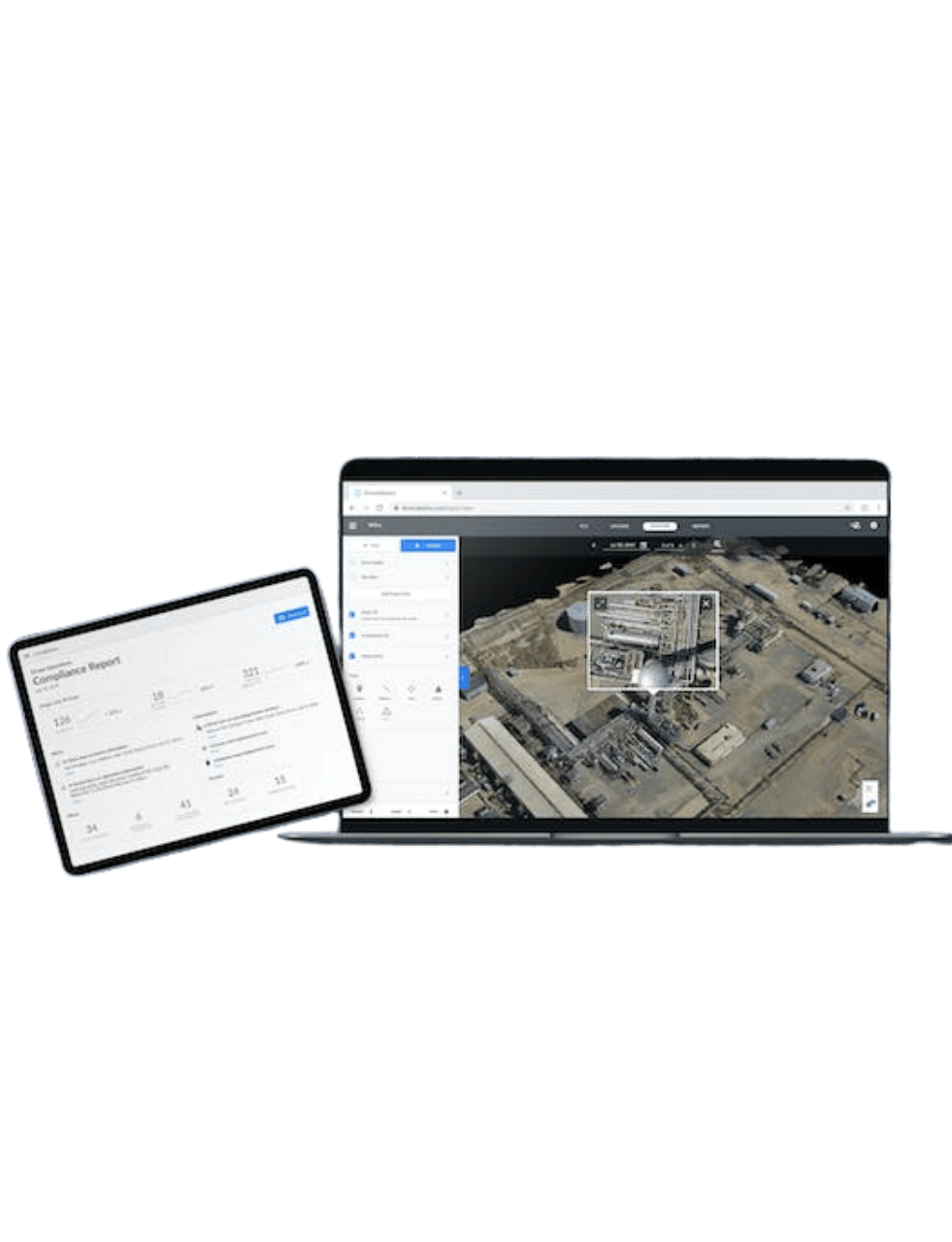
Seamless integration between hardware (GNSS, UAV, scanners) and software (e.g. Esri ArcGIS).
Local Support, Global Innovation
As a local partner backed by global leaders, we provide personalized support while giving you access to the very latest in geospatial innovation.
Products
Explore industry-leading geospatial tools designed for precision, performance, and productivity in every environment.
Explore Our Core Offerings
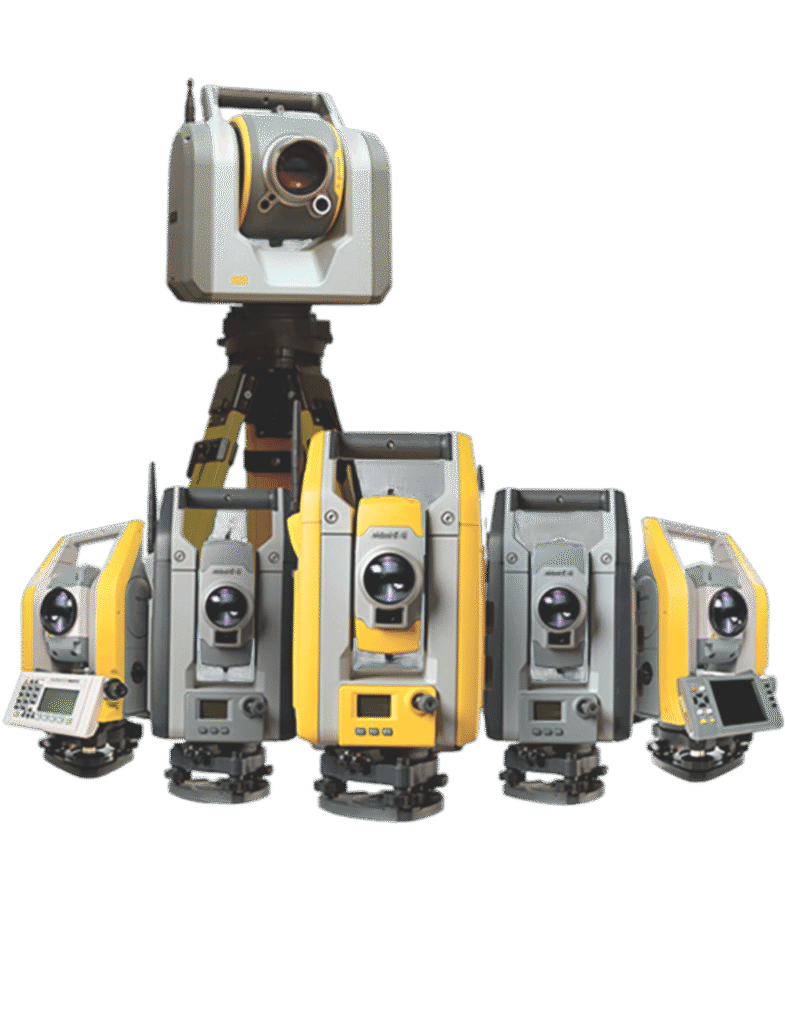
Trimble GNSS Systems
Trimble GNSS systems deliver high-precision positioning solutions trusted by professionals worldwide. Built for reliability and field performance, these systems combine cutting-edge technology with robust design to support surveying, mapping, and construction applications in any environment.
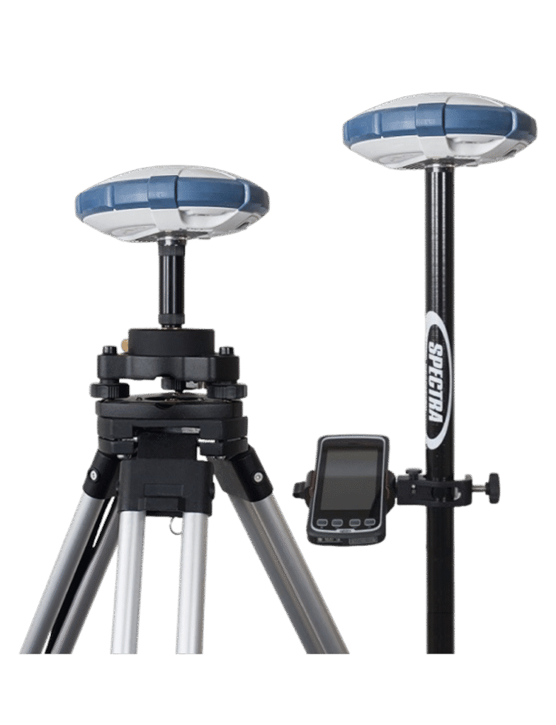
Spectra GNSS surveying
Spectra Geospatial offers reliable and affordable GNSS solutions optimized for professional land surveying and construction layout. With user-friendly interfaces and dependable accuracy, Spectra GNSS equipment is designed for high productivity and ease of use in the field.

Enterprise Drones
Advanced drone solutions for commercial and industrial applications, including surveying, inspection, mapping, and agriculture. These enterprise-grade UAVs integrate high-resolution sensors, real-time data capture, and seamless software workflows to deliver efficient, accurate aerial insights.
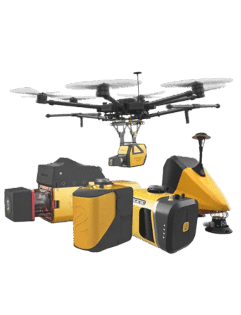
YellowScan LiDAR Solutions
YellowScan LiDAR systems are designed for professional-grade aerial mapping and geospatial data acquisition. Lightweight, fully integrated, and compatible with a wide range of UAVs, YellowScan’s LiDAR solutions deliver high-precision, high-density point clouds for surveying, forestry, mining, and infrastructure projects.
Specialized Solutions
GISsat can also provide niche technologies through HLCM for:
Precision agriculture systems
Advanced GPS- and GIS-enabled tools that support site-specific crop management, soil analysis, and yield optimization—helping farmers improve productivity and reduce input costs.
Asset inventory and utility mapping tools
Tools designed to efficiently collect, map, and manage utility infrastructure and public assets. Ideal for municipalities, utility companies, and asset managers seeking accurate spatial data.
Construction site monitoring and layout systems
Real-time site monitoring solutions, including high-precision positioning and layout tools, to track progress, enforce safety protocols, and streamline construction workflows.
First Data’s mobile data collection & asset management tools
Flexible, field-ready mobile applications for collecting spatial and attribute data, maintaining digital asset inventories, and supporting field crews with real-time updates.
Software for engineering, BIM, and CAD/GIS integration
Integrated platforms that connect Computer-Aided Design (CAD), Building Information Modeling (BIM), and GIS systems—enabling smooth data exchange and visualization for infrastructure planning and design.
Training & Support
Get the most out of your equipment with hands-on training and reliable technical support, every step of the way.

Technical support
Whether it’s GNSS calibration, drone connectivity, or data compatibility, our support team ensures smooth operation across all your geospatial systems, so you can focus on results, not repairs.
E-Learning
If you or your organization have an Esri-qualifying product with a current maintenance subscription, unlimited access to all of Esri's self-paced e-Learning resources is yours to enjoy—anytime from anywhere. It’s learning without limits.
Esri has developed and curated thousands of hours of content for everyone. Relevant training for your role is available whether you’re a student, educator, or professional. There are many ways to learn, with multiple options and formats to meet your needs and content for all stages along your learning journey to help you grow.
With that much content, it could be somewhat daunting to find the training you’re looking for, so we have compiled learning plans containing a list of carefully selected courses to help you reach a specific goal.
If you purchased your own Esri-qualifying product, your access to e-Learning is automatic. Simply find e-Learning that meets your needs in the catalog, and sign in with your Esri Account to immediately start learning.
If you are a member of an organization that has an Esri-qualifying product, you need an Esri Account that is connected to your organization.


Training
Develop in-house capability with customized training programs that match your geospatial tools and workflows. Whether you're onboarding new users or upskilling your team, expert training ensures consistent, high-quality results.
FAQ
Do you offer demos or consultations?
In many cases, we offer product demonstrations, consultations, and workflow assessments to help clients choose the right solution based on their project requirements.
How do I request a quote or place an order?
You can contact us directly via the website, phone, or email. Our team will assist you with product recommendations and provide a detailed quote based on your needs.
Happy Clients
Get Started
Get started with ArcGIS
Request a product
Discover the right tools for your geospatial mission